
Rio Grande Valley Thornforest Restoration
Cartography · Conservation Plan · Science UX
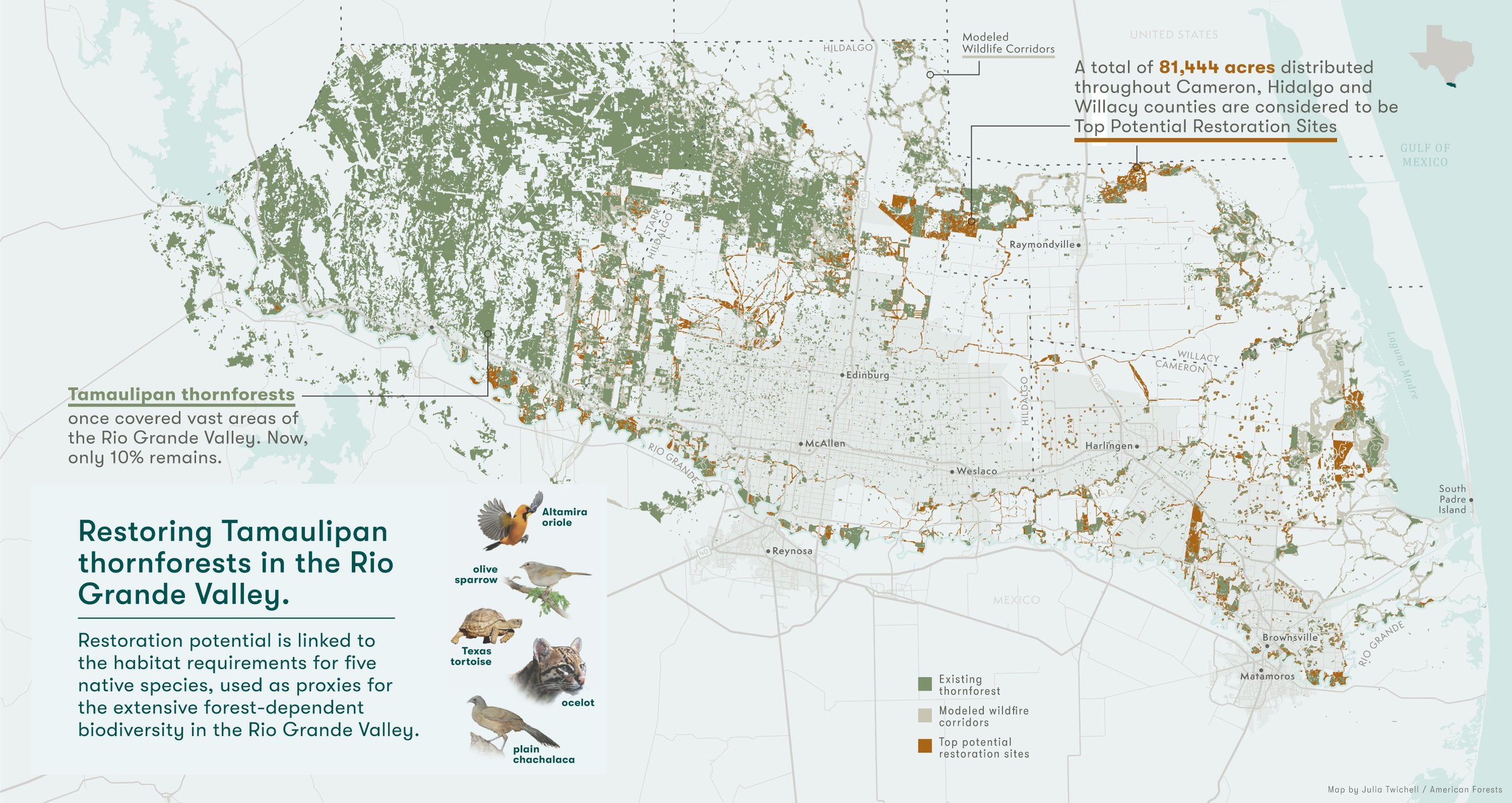
These maps are part of a series of maps created for American Forests’ Thornforest Conservation Plan. This is GIS-based conservation plan that identifies core areas of existing thornforest habitat, potential corridors that link these habitats together and habitat restoration opportunities throughout the Rio Grande Valley and neighboring areas.
The resolution of this data analysis was beautiful to work with—but a challenge to display effectively at this scale. I added callouts to explain the key colors on the map, to reinforce the traditional legend. It was important to convey the urban footprint and how it has fragmented thornforest ecologies in the region. I used Open Street Map highways and primary/secondary/tertiary roads to convey development, and overlaid the urban boundary delineations for US and Mexico to visualize that footprint and the interface between humans and more natural areas. The fragmentation inside those urban areas is striking. The detail captured in the zoomed-in map highlights the beauty of the GIS analysis, which proposes patches that connect and expand the existing fragments of thornforest to create a more connected habitat for the birds, insects, and animals of an incredibly biodiverse region.
It’s both a heartbreaking story of loss and hopeful one—an inspirational story of years-long, cross-jurisdictional, science-driven efforts that are beginning to pay off to restore this incredible habitat.

See all the maps in action in the Thornforest Conservation Plan.


