Linking Fishers to Fishery Management Through Participatory Mapping
Cartography · Data Viz · Georeferencing & Digitizing
Client: Shining Sea Fisheries Consulting
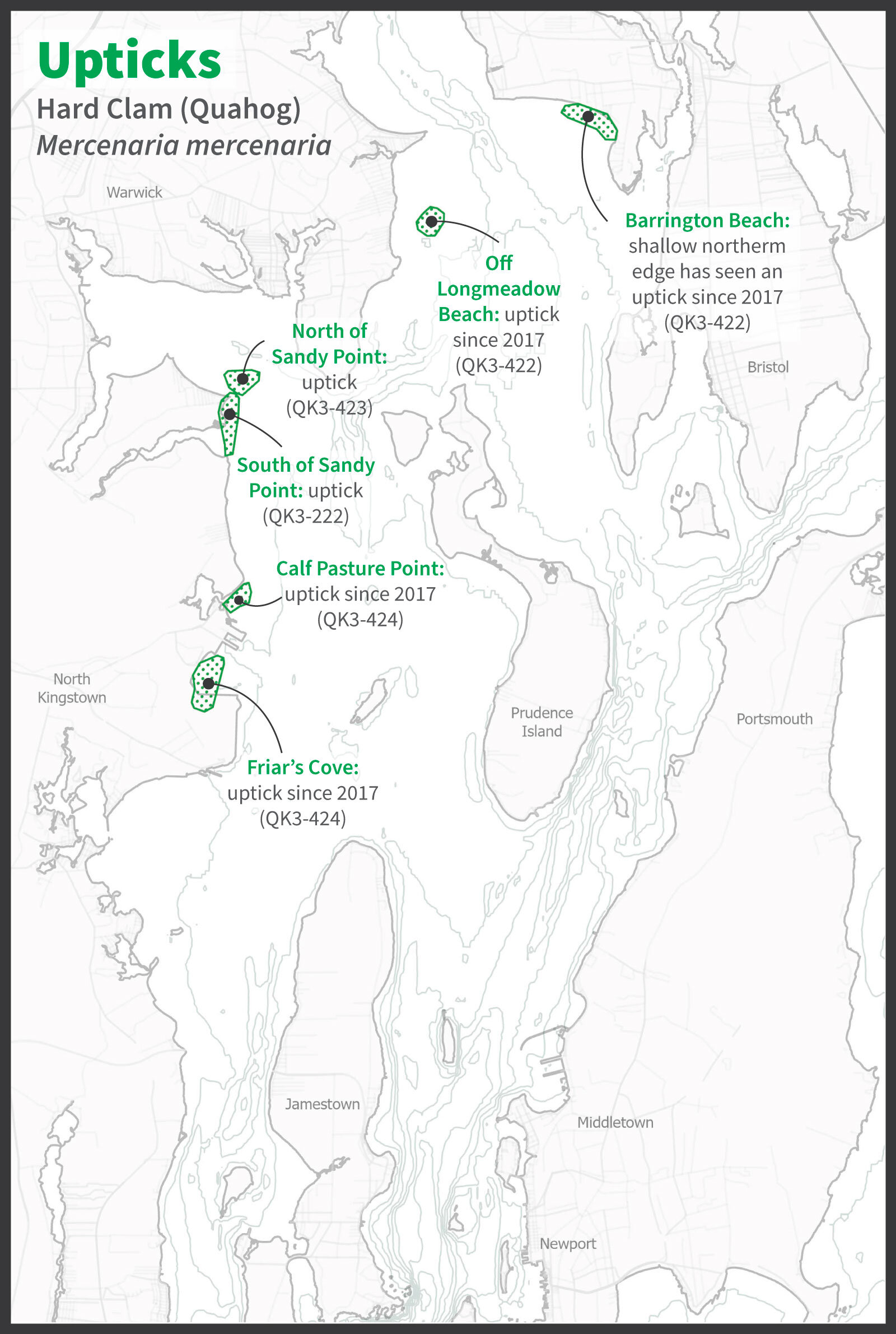
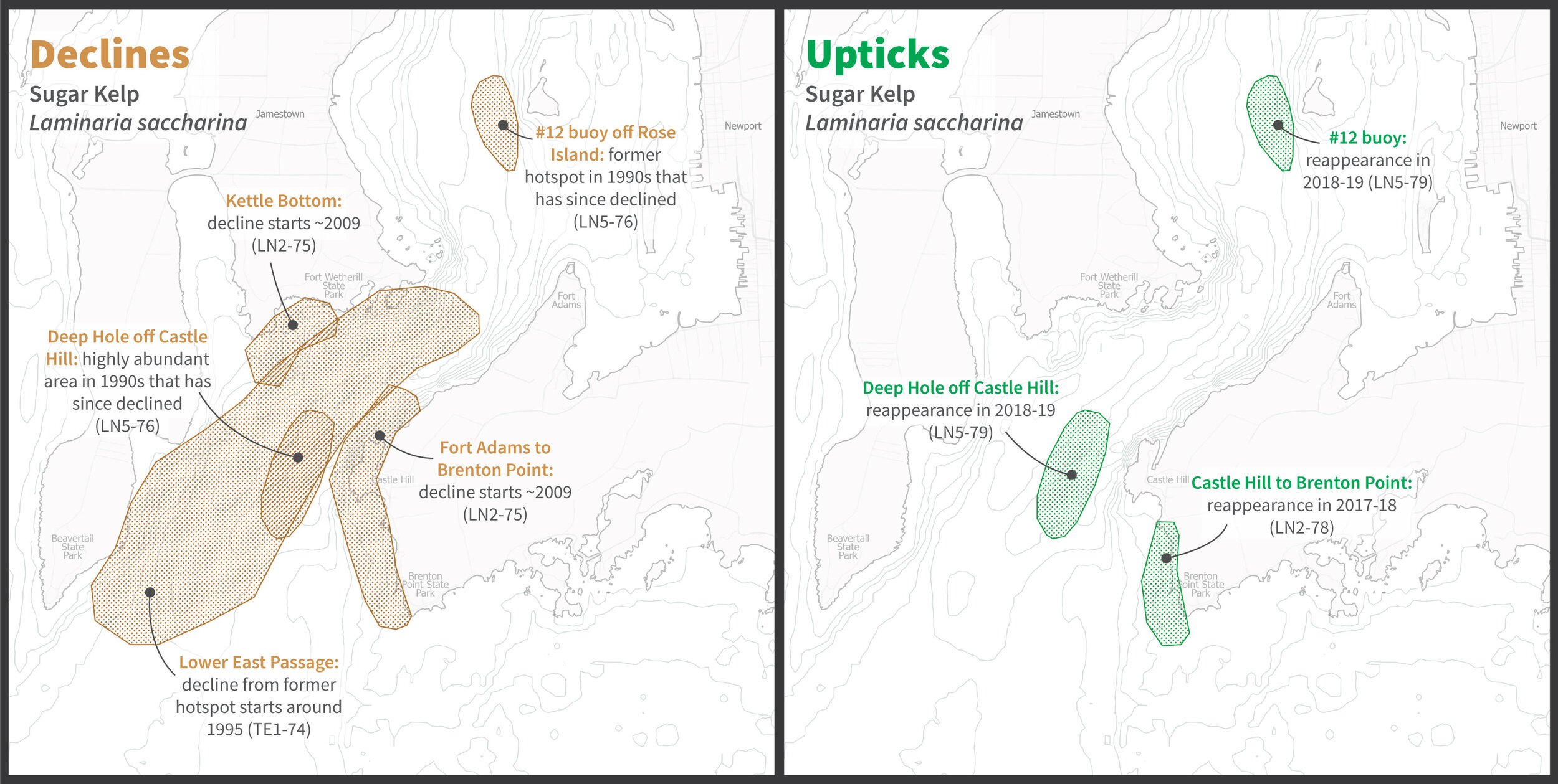
Commercial fishermen are on the water daily. They have rich experience observing the the ecological systems they fish. However, scientists and fisheries managers do not have established mechanisms to work with fisher observations. I partnered with Shining Sea Fisheries Consulting to visualize participatory mapping methods and to interpret and translate the wide-ranging observations of ecological change made by fishermen.
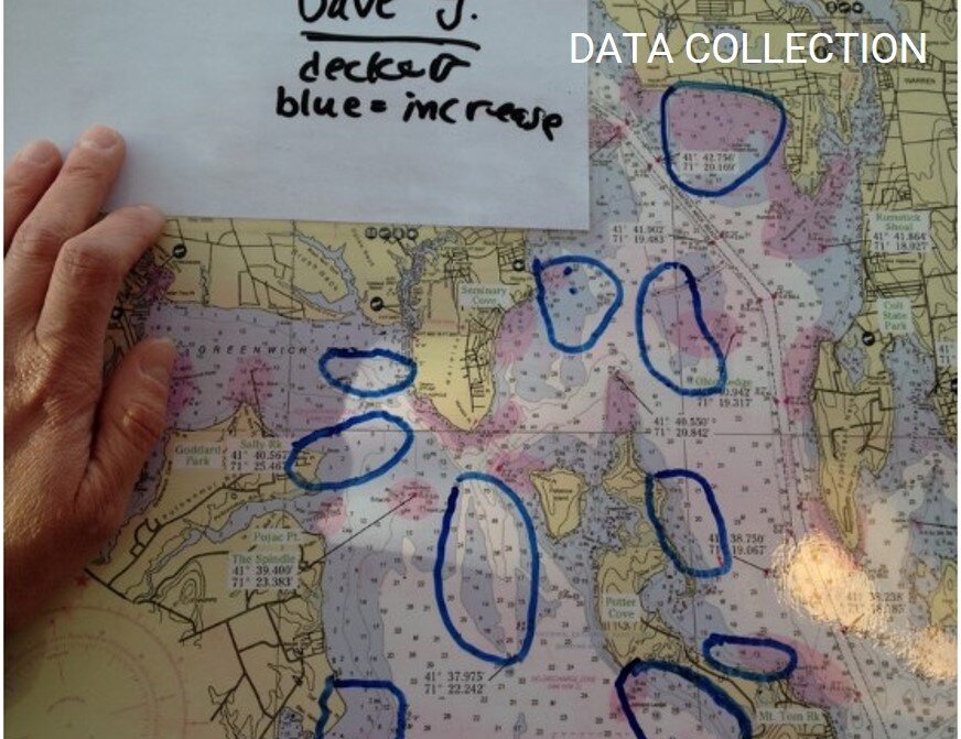
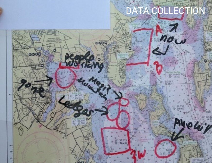
Fishermen were interviewed to locate areas of ecological change. They indicated those areas on marine charts.
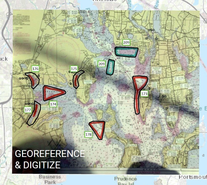
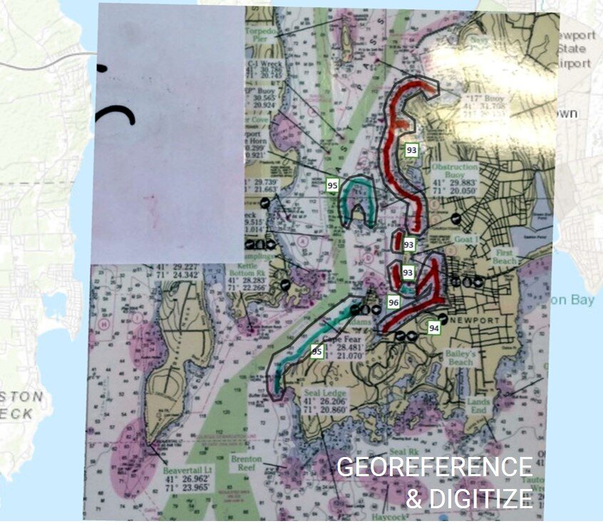
I designed a set of maps to communicate their observations to scientists and fisheries management.